

STRUCTURE


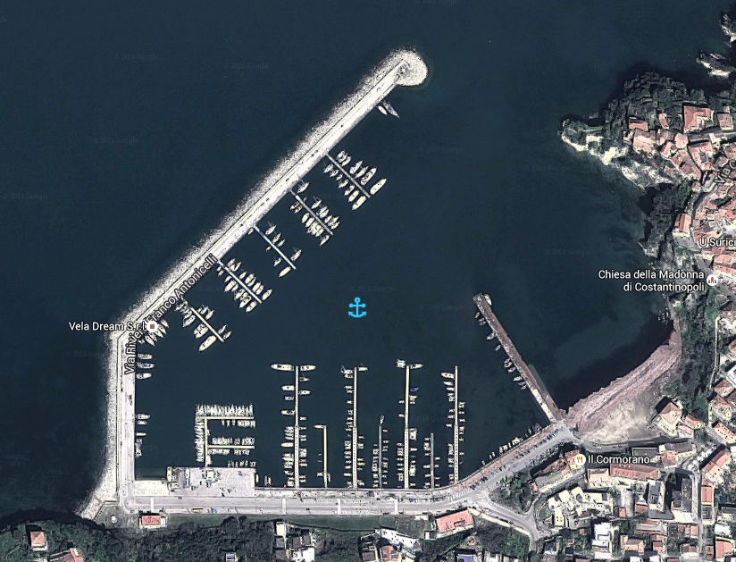
The tourist port of Agropoli is located in Latitude 40 ° 21 ‘N and longitude 14 ° 59’ E in the west of the city.

The water surface of port consists of,

n. 4 concrete piers (A, C, E, F), and 2 floats (the letters B, D) in concession to the City of Agropoli

 n. 9 floating piers in concession to private organized in an association (1,2,3,4,5,7,8,10,11,12 numbers)

n. 2 piers in concession to the ‘Lega Navale Italiana’ (Italian Naval League) and to the ‘Associazione Canottieri Agropoli’ (Association Rowing Agropoli) – (Numbers 6 and 9)

2 areas dedicated to boat rental (number 13-14)
1 area dedicated to charter companies (number 15)
1 dedicated to the refueling area
 2 area dedicated to fishing units within 10m. and over 10mt.

On the outer breakwater there is the communal area devoted to long 57,50 mt transit units that can accommodate from 10 to 40 meters (letter H) and on the wharf there is the Coast Guard, Office of Maritime District of Agropoli and the Services building that hosts: the office of the municipal wharfs, port services and transit, the office of civil protection, training room – courses, civil protection – rescue, cash cards and refills water and electricity, toilets and disabled toilets, showers, laundry room.

It is a port built inside the creek that opens south of Punta del Fortino (about 7 M NNE of Punta Licosa) and consists of an outer breakwater elbow oriented respectively N and NE along 572 meters, a wharf, with a large yard behind, long 327 meters and a breakwater oriented to NNW along 159.43.

The mouth of the port has a width of 145 meters and the subsequent evolution of the basin has a diameter of 165 meters; the seabed for the landing and the evolution in the basin, ranging from 6 to 5 meters for a total availability of approximately 1,100 berths.

View the General plan and Security Services
 

porto_banner-01

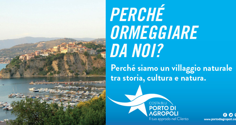
We are a Natural Village between history, culture and nature.

How many good reasons to dock at the Port of Agropoli, your harbor in Cilento.

A unique place to features and location, opens the possibility to experience the sea more ‘blue’ in Campania, in the Blue Coast of Cilento.
Discover the history, the flavors and above all live to 360 ° sea with an offer of services that is enriched every year, thanks to the work of port operators, entrepreneurs, associations and institutions together to promote the incredible heritage of Cilento.

Agropoli , “High City” , the door of the National Park of Cilento, Vallo di Diano and Alburni, is a beautiful tourist place in south of Salerno.

A town that has had a remarkable development in the last few years working on specific assets with investments in culture, urban planning to create sports facilities to make it the city of sport, nature and the sea and at the same time, a place where events and historical heritage make the visit and stay in the rich city of opportunities for fun, relaxation, learning and well-being.

Discover the city on the site dedicated to its tourism promotion “Live Agropoli”; stay updated on the events and the program of the Trentova- Tresino Visitor Center for excursions, outdoor sports activities and much more.

loghi_partner_viviagropoli

Useful links
Maritime District Office of Agropoli
Vivi Agropoli
National Park of Cilento, Vallo di Diano and Alburni
Province di Salerno
Campania Region
Italian Ministry of Infrastructure and Transport


Useful numbers

Coast Guard sea rescue
Agropoli Civil Protection
PSaut Agropoli (fixed locations of the first regional aid): Marrota district
Service coastal
Info point: tourism and hospitality
Municipal police
Tax guard
Police – Emergency number 112
Forestry – Environmental Emergency 1515
City of Agropoli – Port Area and State Property
City of Agropoli – Services building for Piers Handling


Pharmacies *in order of proximity to the Port
Barlotti
Paraggio Voza
Materazzi – Cantalupo
Farmacia Comunale CFI


Drugstore at 200mt. from Porto
Drugstore dott.Cuozzo

  tel. 1530
  tel. 0974 829488
  tel. 0974 8275465
  tel. 331 7758782
  tel. 0974 822999
  tel. 0974 827424
  tel. 0974 823006
  tel. 0974 828369 – 0974 828312
  tel. 0974 968285
  tel. 0974 827420 – 827454
  tel. 0974 823583


  tel. 0974 823054 | su mappa
  tel. 0974 823004 | su mappa
  tel. 0974 828204 | su mappa
  tel. 0974 823260 | su mappa


  tel. 0974 828408 | su mappa

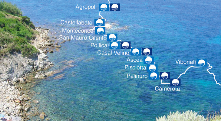
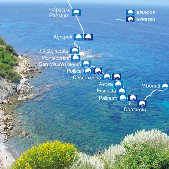
The Cilento and Vallo di Diano  is an extraordinary land that gave birth to the Mediterranean diet, which has the most beautiful sea, witnessed by 12 Blue flags and recognized the historical value as the colony of Ancient Greece, the cradle of civilization.

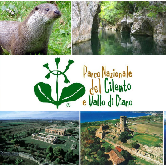
The Cilento is a mountainous area of ​​Campania in the province of Salerno, in the southern part of the region; for the uniqueness of its biodiversity is a UNESCO World Heritage Site. The area is limited to the north by the chain of mountains Alburni and faces east in the Vallo di Diano. It derives its name from cis Alentum (“this side Alento”), although the river is not it more the boundary signs. Its hilly territory covered by olive trees has always been a crossroads of peoples and traditions. Crossed by lively streams, rich in chestnut and holm oak, its beautiful landscape is interrupted by villages clinging to the rocks or laid on the sea shores, most of which is also part of the Cilento National Park and Vallo di Diano, with sites archaeological area of ​​Paestum and Velia and the Certosa di Padula, inserted in 1998 in the world heritage list of UNESCO.

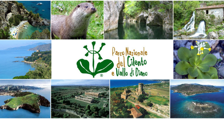
The National Park of Cilento and Vallo di Diano, second largest park in Italy in size, includes the peaks of the Alburni, Cervati and Gelbison and the coastal buttresses of Mount Bulgheria and Mount Stella. The flora of the park is made up of about 1,800 different species of wild native plants, but also the fauna is very diversified thanks to the varied and somewhat impervious territory, coastal and mountainous areas, rivers and streams, cliffs and forests, the habitat of many wildlife areas bolster the presence of species of high conservation value, such as the peregrine falcon.

The extraordinary natural characteristics, due to the considerable heterogeneity of the territory, are flanked by the mythical and mysterious character of a land rich in history and culture: the call of nymph Leucosia, the beaches where the destinies of Aeneas Palinuro and have separated, the remains of Greek colonies and Paestum, the wonderful Certosa di Padula. The latter three sites are the main cultural attractions of national and international importance that have allowed the park to get the prestigious award of UNESCO released the UNESCO World Heritage.

Cilento and Valle del Sele there are many local products from the oil to cheese, from wine to beans, a well-established maritime tradition of culinary art that has been handed down for generations, from fishermen to farmers Cilento hinterland. Remember: the Cilento DOP olive oil, the Roccadaspide IGP Brown, white figs of Cilento, the Paestum artichokes IGP Tondo, the Controne bean, Anchovies Menaica, the brawn of Gioi, honey Park Cilento, the cacioricotta, buffalo mozzarella, the caciocavallo, mozzarella co ‘to mortedda, the wine of Cilento.

National Park of Cilento and Vallo di Diano


COSTA BLU of CILENTO is the destination brand that uniquely identifies the Cilento beach resorts, among the most awarded every year with the banner “Blue Flag” assigned by Italy Fee (Foundation for Environmental Education). It is synergistic understanding of environmentally sustainable development and tourism development aimed at the Cilento coastal municipalities Blue Flag awarded for the creation of a system of activities that suggest what purpose the protection and enhancement of environmental and cultural heritage of the coastal territory Cilento, recognized World Heritage Site, which includes the marine protected Areas of Santa Maria di Castellabate, Infreschi Coast and Asseta. Among the objectives of the agreement between the mayors of the municipalities concerned: the use of the name “Blue Coast Cilento” of all the tourist and corporate communication tools, joint actions for environmental protection, tourism promotion activities.

The municipalities covered by the Blue Coast of Cilento project are:
Agropoli, Camerota, Capaccio Castellabate, Montecorice, Casal Velino, Ascea, Pisciotta, Centola-Palinuro, San Giovanni a Piro, San Mauro Cilento, Santa Marina, Vibonati, Sapri.

At the port of Agropoli there are quality accommodation, excellent restaurants to sample the fresh fish that every day arrive at the port due to the passion of Agropoli fishermen who engage in the reef fishing and the two large vessels fishing in the harbor.

The catch (cuttlefish, bream, pezzogne, octopus, red mullet, pink shrimp and others) combined with the typical Cilento products like the popular white figs Cilento DOP, the DOP buffalo mozzarella, the oil dop Cilento and many other , complete the offer of tourism with a gastronomic proposal is based on the Mediterranean Diet , the famous lifestyle around the world and that in Cilento saw its birth and theorizing by the biologist and physiologist Ancel Keys.


Visit and test the offer of:
* indicate activities within 500mt. from the port area

mappe_sito_porto-04

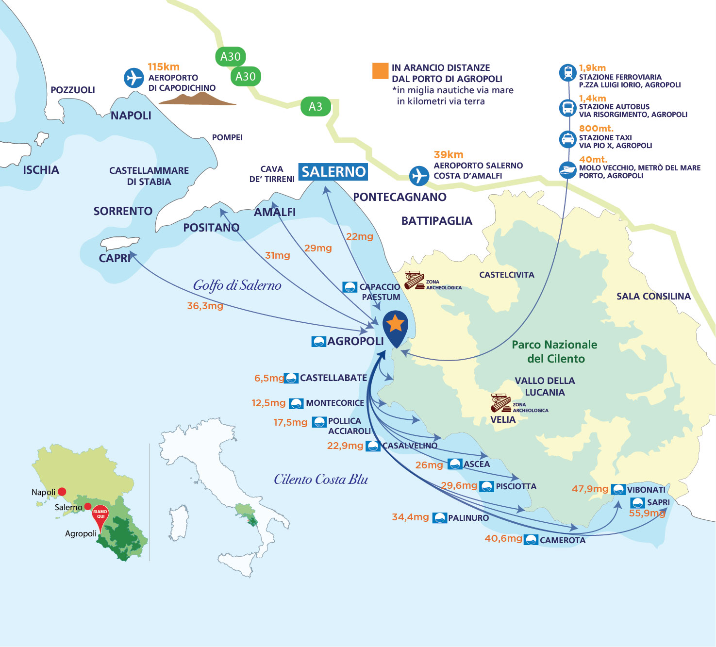
WHERE WE ARE


HOW TO REACH

BY SEA
Coordinates 40 ° 21’33 N, 14 ° 58’95E.
Approach: to enter the port of Agropoli direct to Punta Fortino to starboard of the lighthouse from the unmistakable Venetian architecture, complete with a white blackbirds. Upon entering, keep to starboard. The access time is continuous. The port is a natural inlet protected by an outer breakwater at the root of which lies the shore quay and a pier.
The seabed is sand and rocks from 1 to 5 meters.
Light and lighthouses: lighthouse 2660 GPR2, white lambi periodic 6 sec., range 13 mg. Fortino NW tip of the city 2661 light flashes green, periodic 5 sec., range 5 mg. The head of the pier breakwater 2661-2 red light taillight fixed, brought 4mg., on the outer breakwater head.


BY CAR
From Naples and Salerno follow the highway A3 SA / RC exit Battipaglia. Take the SS 18 following the signs for Agropoli. Exit at Agropoli Nord and follow the directions for Porto

Google Maps   Street View


BY TRAIN
Agropoli railway station is ‘Agropoli-Castellabate’ and can be reached with regional and intercity trains. Soon the high speed of up to Sapri direct stop in Agropoli will be active (during 2016)

Trenitalia


BY BOAT
The Metrò del Mare (hydrofoil) will be active from July 2016 with the following lines:
Line 1: Salerno – Cilento Coast, with connections to / from Salerno to Agropoli, San Marco, Acciaroli, Casal Velino, Pisciotta, Palinuro Camerota; active line on Saturday and Sunday.
Line 2: Cilento-Amalfi Coast, with connections to / from Salerno to Agropoli, San Marco, Amalfi, Positano, (connection to Capri); It operates from Monday to Friday online.
Line 3 / A: Cilento (Sapri- Capri – Naples) with cCollegamenti A / R from Sapri to Camerota, Pisciotta, Casal Velino, Capri and Naples; active on Tuesdays, Wednesdays and Thursdays line. Line 3 / B: Cilento (Sapri – Capri – Naples) with connections to / from Sapri Palinuro, Acciaroli, San Marco, Capri and Naples; Active on Monday and Friday.

Metrò del Mare


BY PLAN
The main airport of Campania is the Naples International Airport which is 112km from Agropoli (1:38 a.m.” by car). From june 3 will be possible to reach even the nearest Agropoli Salerno-Costa d’Amalfi Airport which is 36km from Agropoli (45” by car) with departures from Milan, Ibizia, Malta and Corfu

Aeroporto di Salerno-Costa d’Amalfi


Categorie

  • Annunci
  • Riviste

    Pubblica il tuo annuncio, o mandaci il tuo articolo a comunicazione@portodiagropoli.com